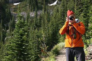
Officially, this quintessential Olympic Peninsula trail makes an excellent day hike, but I spent the night. My friend Brian was especially keen to take sunset and sunrise photos, so it seemed best to bring a tent and enjoy a night atop Marmot Pass.
 Basic details of Marmot Pass are pretty straightforward: 3500 feet at the trailhead, rising to 6000 feet at the pass; a 10.6-mile round trip journey great views, etc.
 Blah, blah, blah.
In my mind, the book details are simply that – two-dimensional text. Real high-definition appreciation comes only when one takes a walk along the pass trail itself.
 The trail enters the Buckhorn Wilderness straight away, and for the first two miles Brian and I hiked amongst towering old growth peacefully progressing adjacent to the Big Quilcene River. At 2.5 miles in, we came reached Shelter Rock Camp, a nice enough intermediate campsite I suppose, especially if you have small children, but Brian and I had our sights focused higher up the mountain. After a few pleasantries with others at this lower encampment along with quick check of our map, we affixed Shelter Camp and the thick canopy of gigantic trees squarely to our rearview mirror.
 Progressing through the next two miles, the trail climbed in and out of forested patches, but seemingly made its home mostly in small, enchanted meadows.
 The trail climbs steadily the entire way, but it never too steep, provided you have some base fitness to draw from coupled with solid footing. However, I did have a hard time keeping up Brian at times. Whether it be on foot or bicycle, he simply loves to go ascend, and relishes any opportunity to do so, our ascent no exception.
To be honest, I think he took special pleasure in emphatically demonstrating his superior hiking strength. But in my defense, Brian posses a secret training weapon which with I cannot compete – mainly his incessant carrying of a toddler atop his shoulders.
 Getting back to the trail … approximately 4.5 miles from the trailhead Camp Mystery, generously offered us a few open campsites to select from, all of which are just off the trail and conveniently next to an endless supply of ice-cold water.
 Having selected out site, dripping in sweat, and definitely ready for dinner, we wasted no time setting-up camp and preparing our cuisine of instant Lentil soup, some almonds pretzels, and hot tea.
 Following dinner we decided to wander a bit and further explore the nearby pass and take in some sunset views. Along the way, we spotted a few secluded campsites, which we both agreed were superior to our real estate (I’ll make a note to self for next time I’m there).
Just prior to reaching the final climb to the pass, a large open meadow takes the trail the rest of the way up to Marmot Pass. As you might imagine, the views up top are breathtaking - some of the tallest Olympic peaks, the Dungeness Valley, Hood Canal, the Cascades and more.
Similar to the two-dimensional text I previewed prior to my arrival, the enclosed pictures to not serve this area justice. Given the opportunity, you to should capture your very own high-definition experiences.
I’m quite certain your experience atop Marmot Pass will be as good as mine.
Brian's digital appendage


No comments:
Post a Comment